British Overseas Territories
The British Overseas Territories comprise fourteen territories of the United Kingdom that fall under its jurisdiction. They are all that remains of the former British Empire that have not acquired independence or have voted to remain British territories. The term British Overseas Territory was introduced by the British Overseas Territories Act 2002 replacing the name British Dependent Territory previously introduced by the British Nationality Act 1981. Before this 1981 Act, the territories were known as Crown colonies.
Apart from the British Antarctic Territory, which contains only research stations, and the Sovereign Base Areas on Cyprus and the British Indian Ocean Territory, which are military bases, all the overseas territories have permanent populations.
| Name |
Location |
Area |
Approx Population |
Capital |
| Anguilla |
Caribbean and North Atlantic Territories |
146 km2 |
13 000 |
The Valley |
| Bermuda |
North Atlantic Ocean |
54 km2 |
64 000 |
Hamilton |
| British Virgin Islands |
Caribbean and North Atlantic Territories |
153 km2 |
27 000 |
Road Town |
| Cayman Islands |
Caribbean and North Atlantic Territories |
259 km2 |
60 000 |
George Town |
| Falkland Islands |
South Atlantic Ocean |
12 173 km2 |
3000 |
Stanley |
| Gibraltar |
Europe: Iberian Peninsula |
6.5 km2 |
29 000 |
Gibraltar |
| Montserrat |
Caribbean and North Atlantic Territories |
101 km2 |
5000 |
Plymouth [abandoned] |
| Pitcairn Islands |
South Pacific Ocean |
45 km2 |
50 |
Adamstown |
| Saint Helena, Ascension and Tristan da Cunha |
South Atlantic Ocean |
420 km2 |
6000 |
Jamestown |
| South Georgia and the South Sandwich Islands |
South Atlantic Ocean |
4066 km2 |
100 |
King Edward Point / Grytviken |
| Turks and Caicos Islands |
Caribbean and North Atlantic Territories |
430 km2 |
32 000 |
Cockburn Town |
The British Overseas Territories with permanent populations
 Anguilla Anguilla
Anguilla was first settled by Amerindian tribes from South America around 1300 BC, and remains of settlements date from 600 AD. The island was first discovered by the French in 1564. Anguilla was first colonised by English settlers from Saint Kitts in 1650. The French temporarily took over the island in 1666 but under the Treaty of Breda it was returned to English control.
Originally Anguilla was administered by the British through Antigua, but in 1824 it was placed under the administrative control of nearby Saint Kitts. In 1967 Britain granted Saint Kitts and Nevis full internal autonomy, and Anguilla was also incorporated into the new unified dependency, named Saint Christopher-Nevis-Anguilla, against the wishes of many residents and this led to two rebellions in 1967 and 1969and a brief period as a self-declared independent republic. British authority was fully restored in July 1971. In 1980 Anguilla was finally allowed to secede from Saint Kitts and Nevis and become a separate British colony.
The majority of residents are the descendants of slaves transported from Africa.
Local law requires that all information collected from the decennial census must be kept confidential.
It is doubtful that a researcher will find many surviving records. In 2008 the Court House in The Valley that held the archives was converted into a restaurant for the Members of Parliament. The first recognised archivist in 1980 was appointed with no salary and an annual budget of $1 when it was revealed that archival records were being burnt to free up filing cabinets for the Minister for Social Services. Registrar of Births, Deaths and Marriages is located in The Valley, FamilySearch have filmed births 1901–1930., marriages 1916–1930, deaths 1901–1910, St Marys and other parish registers.
 Bermuda Bermuda
Although usually referred to in the singular, the territory consists of 181 islands, with a total area of 53.3 square kilometres (20.6?sq?mi). The largest island, Main Island, sometimes itself called Bermuda.
Bermuda was discovered in 1505 by Spanish navigator Juan de Bermudez who claimed it for the Spain. Unoccupied, the island was settled by England in 1609, making it the oldest remaining British overseas territory. Its first capital, St George's, was established in 1612 and is the oldest continuously inhabited English town in the Americas.
Because of its limited land area, Bermuda has had difficulty with over-population. In the first two centuries of settlement it relied on steady human emigration to keep the population manageable over half of the population emigrated, primarily to the American South, where Great Britain was displacing Spain as the dominant European imperial power.
Bermuda is divided into nine parishes and two municipalities.
Bermuda's nine parishes:
- Devonshire
- Hamilton
- Paget
- Pembroke
- St George's
- Sandys
- Smith's
- Southampton
- Warwick
Bermuda's two incorporated municipalities:
- Hamilton (city)
- St George's (town)
Bermuda Archives holdings consist of the permanent and historic records of the legislative, executive and judicial branches of the Bermuda Government and the private papers relating to Bermuda, which are donated by private organizations, institutions and members of the public. The collection includes Anglican and Presbyterian church registers, military records, immigration records, Wills and probate records (1720–1969) and a range of compiled indexes and transcriptions. No material is available online. Civil registration commenced in 1866 for births and marriages and 1865 for deaths. These records are held by the Registry General in Hamilton. The Bermuda Historical Society based in the Bermuda Library in Hamilton and the St George's Historical Society Foundation can also assist with family history research. The Bermuda Library also holds useful material including newspapers from 1784.
 British Virgin Islands British Virgin Islands
The islands make up part of the Virgin Islands archipelago and consist of the main islands of Tortola, Virgin Gorda, Anegada and Jost Van Dyke, along with over fifty other smaller islands and cays. Only 15 of the islands are inhabited.
The Virgin Islands were first settled by the Arawak from South America around 100 BC until the 15th century when they were displaced by the Caribs from the Lesser Antilles islands.
The first European sighting of the Virgin Islands was by Christopher Columbus in 1493 on his second voyage to the Americas. Columbus gave them the name Saint Ursula and her 11 000 Virgins.
The Spain claimed the islands by discovery in the early 16th century, but never settled them, and subsequent years saw the English, Dutch, French, Spanish and Danish all jostling for control of the region with the Dutch establishing a permanent settlement on the island of Tortola by 1648. In 1672, the English captured Tortola from the Dutch, and the English annexation followed in 1680. In the period 1672 to 1733, the Danish gained control of the nearby islands of St Thomas, St John and St Croix. In 1917, the United States purchased St John, St Thomas and St Croix from Denmark for US$25 million renaming them the United States Virgin Islands.
The British Virgin Islands were administered variously as part of the British Leeward Islands or with St Kitts and Nevis, with an Administrator representing the British Government on the Islands. Separate colony status was gained for the Islands in 1960 and the Islands became autonomous in 1967.
The British Virgin Islands maintains a National Archives. The first Government Archivist was appointed in September 2007. A separate Registrar of Births, Deaths and Marriages is maintained in Tortola.
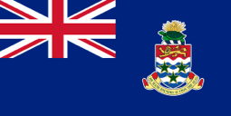 Cayman Islands Cayman Islands
The Cayman Islands located in the western Caribbean Sea comprise of three islands of Grand Cayman, Cayman Brac, and Little Cayman.
The islands were first sighted by Christopher Columbus in May 1503 during his fourth voyage to the New World. The first recorded English visitor to the islands was Sir Francis Drake in 1586 and he named the islands Cayman after caiman.
The Cayman Islands remained largely uninhabited until the 17th century when, a variety of settlers made their home on the islands. This grouping of people from various backgrounds included pirates, refugees from the Spanish Inquisition, shipwrecked sailors, and deserters from Oliver Cromwell's army in Jamaica.
The first recorded permanent inhabitant of the Cayman Islands, Isaac Bodden, was born on Grand Cayman around 1661. He was the grandson of the original settler named Bodden who was one of Oliver Cromwell's soldiers at the taking of Jamaica in 1655. England took formal control of the Cayman Islands, along with Jamaica, under the Treaty of Madrid in 1670. Following several unsuccessful attempts at settlement, residency in the islands began in the 1730s.
The islands continued to be governed as a single colony with Jamaica until 1962 when they became a separate Crown colony while Jamaica became an independent Commonwealth realm.
The Cayman Islands maintains a National Archive in George Town. The Cayman Islands Government General Registry, the registrar of births, deaths and marriages, among other duties, is also located in George Town.
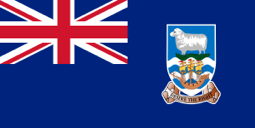 Falkland Islands Falkland Islands
The Falkland Islands is an archipelago in the South Atlantic Ocean off the coast of mainland South America. The archipelago consists of East Falkland, West Falkland and 776 lesser islands. The capital, Stanley, is on East Falkland.
The islands were uninhabited when they were discovered by Europeans and the first reliable sighting is attributed to the Dutch explorer Sebald de Weert in 1600. The French founded the first settlement on Berkeley Sound, in present-day Port Louis, East Falkland in 1764. In 1765, the British claimed Saunders Island on West Falkland and a settlement was constructed in 1766 and unaware of the French presence the islands were claimed by Britain.
Spain acquired the French colony and attacked Port Egmont expelling the British in 1770, but war was avoided by a peace treaty and the British return to Port Egmont.
In 1774, economic pressures forced Great Britain to withdraw from many overseas settlements and upon withdrawal the British left behind a plaque asserting her continued claim. Spain maintained its presence until 1806 and on departure, also left behind a plaque asserting Spanish claims. In 1820, storm damage forced the privateer Heroína to take shelter in the islands and the captain raised the flag of the United Provinces of the River Plate and read a proclamation claiming the islands. A settlement was established in 1828 after seeking authorisation from both British and Argentine authorities. A raid by the US warship USS Lexington in 1831 destroyed the settlement.
In November 1832, Argentina established a penal settlement but the following January, British forces returned and requested the Argentine garrison leave. From 1834 the islands were governed as a naval station until 1841 when the British Government decided to establish a permanent colony.
In 1945, Argentina asserted its right to sovereignty over the Falkland Islands leading to an invasion in 1992 and although eventually repelled by British forces maintain the claim. The Falkland Islanders themselves are almost entirely British and maintain their allegiance to the United Kingdom.
The Jane Cameron National Archives is the official national archive of the Falkland Islands renamed in 2010 to recognise the first archivist appointed in 1989. Government records in the Falklands were started by the first Governor of the Falkland Islands, Richard Moody, in 1841. The Archive offers a research service for most projects with payment is in advance.
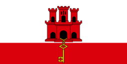 Gibraltar Gibraltar
Gibraltar is located on the southern end of the Iberian Peninsula at the entrance of the Mediterranean with a northern border with Spain.
An Anglo-Dutch force captured Gibraltar in 1704 during the War of the Spanish Succession. The territory was subsequently ceded to Britain by Spain under the Treaty of Utrecht in 1713. The sovereignty of Gibraltar is a major point of contention in Anglo-Spanish relations as Spain asserts a claim to the territory. Gibraltarians resoundingly rejected proposals for Spanish sovereignty in referenda held in 1967 and 2002.
Gibraltarians hold full British citizenship.
The Gibraltar Archives was established in 1969 for the collection and preservation of public records. As well as public records, the collection includes historical records pertaining dating back to the 18th century from various bodies and institutions involved in the day-to-day administration of Gibraltar. Some private individuals, groups and associations have also deposited their records.
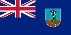 Montserrat Montserrat
Montserrat is located in the Leeward Islands, part of the chain of islands called the Lesser Antilles in the West Indies. Christopher Columbus gave Montserrat its name on his second voyage to the New World in 1493, after Montserrat mountain located in Barcelona, Montserrat is nicknamed the Emerald Isle of the Caribbean, both for its resemblance to coastal Ireland and for the Irish ancestry of its inhabitants.
Montserrat was populated by Arawak and Carib native peoples when it was claimed by Christopher Columbus on his second voyage in 1493 but the island fell under English control in 1632 when anti-Catholic violence in Nevis forced a group of Irish, many of whom had been unwillingly transported from Ireland as indentured servants, to settle in Montserrat. In 1782, during the American Revolutionary War, Montserrat was briefly captured by France and was returned to the United Kingdom under the Treaty of Paris which ended that conflict.
From 1871 to 1958 Montserrat was administered as part of the Federal Colony of the British Leeward Islands, becoming a province of the short-lived West Indies Federation from 1958 to 1962.
Montserrat's historic capital city of Plymouth was destroyed and two-thirds of the island's population were forced to flee abroad by an eruption of the previously dormant Soufriere Hills volcano that began on 18 July 18 1995. The village of Brades serves as the temporary centre of government until a new town at Little Bay in the north of the island is constructed.
Montserrat is divided into three parishes:
- Saint Anthony Parish
- Saint Georges Parish
- Saint Peter Parish
Only Saint Peter Parish is currently inhabited
The people of Montserrat were granted full residency rights in the United Kingdom in 1998, and citizenship was granted in 2002.
The Government of Montserrat Archives status is unknown. On 18 July 1995, the Soufrière Hills volcano destroyed the capital city of Plymouth. A new town and port is being developed at Little Bay on the northwest coast of the island. While this construction proceeds, the centre of government and businesses is at Brades.
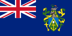 Pitcairn Islands Pitcairn Islands
The Pitcairn Islands officially named the Pitcairn, Henderson, Ducie and Oeno Islands, form a group of four volcanic islands in the southern Pacific Ocean.
The islands are best known as home of the descendants of the Bounty mutineers and the Polynesians who accompanied them and this history is still evident in the surnames of many of the islanders. With only about 50 inhabitants from four families: Christian, Warren, Young, and Brown, Pitcairn is the least populous jurisdiction in the world and the smallest democracy in the world.
In 1790, nine of the mutineers from the Bounty and Tahitian companions (six men, 11 women and a baby), some of whom may have been kidnapped, settled on Pitcairn Island and set fire to the Bounty. Alcoholism, murder, disease and other ills took the lives of most mutineers and Tahitian men. The Pitcairn islanders reported that it was not until 27 December 1795 that the first ship since the Bounty was seen from the island, but as it did not approach the land, they could not make out to what nation it belonged. A second appeared some time in 1801, but did not attempt to communicate with them. A third came sufficiently near to see their habitations, but did not venture to send a boat on shore. The American trading ship Topaz was the first to visit the island and communicate with them when they spent 10 hours at Pitcairn in February 1808.
After the rediscovery of Pitcairn, John Adams, the only surviving mutineer, was granted amnesty for his mutiny.
Pitcairn Island became a British colony in 1838. In the mid-1850s the Pitcairn community was outgrowing the island and its leaders appealed to the British government for assistance. They were offered Norfolk Island and on 3 May 1856, the entire community of 193 people set sail for Norfolk on board the Morayshire, arriving on 8 June. But after eighteen months on Norfolk, seventeen of the Pitcairners returned to their home island; five years later another twenty-seven did the same.
The Pitcairn Islands currently have a population of about 65 and no official archives are maintained.
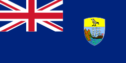 Saint Helena, Ascension and Tristan da Cunha Saint Helena, Ascension and Tristan da Cunha
Saint Helena, Ascension and Tristan da Cunha consists of the islands of Saint Helena, Ascension Island and the Tristan da Cunha group and was known as Saint Helena and Dependencies until September 2009, when a new constitution came into force giving the three islands equal status within the territory.[
The Portuguese found Saint Helena uninhabited, but formed no permanent settlement. In developing their Far East trade, the Dutch made a formal claim in 1633, but did not settle and by 1651 largely abandoned it in favour of their colony at the Cape of Good Hope.
In 1657, the English East India Company was granted a charter to govern Saint Helena by Oliver Cromwell and the following year the Company decided to fortify and colonise the island with planters and as such it is Britain's second oldest remaining colony after Bermuda.
The territory is an Overseas Country or Territory of the European Union, with limited aspects of European Union membership applied to its administration, its laws and its citizens. It does not however form part of the European Union
Edinburgh of the Seven Seas, the main settlement of the island of Tristan da Cunha is regarded as the most remote permanent settlement in the world, being over 1500 miles / 2400 km from the nearest human settlement, on Saint Helena.
The Government Archivist in Jamestown on St Helena Island undertakes paid research on requests. The collection comprises church and civil registered birth, marriage and death records. The church records commence in 1680 while civil registration commenced in 1852. Shipping records date from 1855 while East India Company records cover the period 1673 to 1836. There are no surviving shipping records for 1836 to 1852. Deeds and leases are available from 1682 to 1885. Wills from 1682 to 1839 are listed as are headstones on St Helena. Much of the material held by the archivist have been filmed and are available through FamilySearch—this information and other material is outlined on the St Helena Institute website.
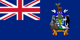 South Georgia and the South Sandwich Islands South Georgia and the South Sandwich Islands
South Georgia and the South Sandwich Islands is a remote collection of islands, consisting of South Georgia and a chain of smaller islands, known as the South Sandwich Islands. There is no local permanent population on the islands; the present inhabitants are the British Government Officer, Deputy Postmaster, scientists, and support staff from the British Antarctic Survey who maintain scientific bases at Bird Island and at the capital, King Edward Point, as well as museum staff at nearby Grytviken.
The United Kingdom claimed sovereignty over South Georgia in 1775 and the South Sandwich Islands in 1908. In 1908 the United Kingdom annexed both South Georgia and the South Sandwich Islands. The territory was formed in 1985 having previously been part of the Falkland Islands Dependencies. Argentina claimed South Georgia in 1927 and claimed the South Sandwich Islands in 1938.
Argentina maintained a naval station, Corbeta Uruguay on Thule Island in the South Sandwich Islands from 1976 until 1982 when it was closed by the Royal Navy. Argentina continues to claim sovereignty.
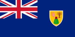 Turks and Caicos Islands Turks and Caicos Islands
The Turks and Caicos Islands consist of two groups of tropical islands in the Caribbean, the larger Caicos Islands and the smaller Turks Islands. The forty islands and cays are geographically contiguous to the Bahamas.
The first inhabitants of the islands were the Taíno people who from Hispaniola sometime from 500 to 800. The first documented European to sight the islands was Spanish conquistador Juan Ponce de León in 1512. Soon after they arrived in the islands the Spanish began capturing the natives as slaves to replace the largely depleted native population of Hispaniola. The southern Bahama Islands, including the Turks and Caicos Islands, were completely depopulated by about 1513, and remained so until the 17th century. During the 16th, 17th and 18th centuries, the islands passed from Spanish, to French, to British control, but none of the three powers established settlements. Bermudian salt collectors settled the Turk Islands around 1680. In 1765–1783 they were under French occupation and again after the French captured the archipelago in 1783. After the American Revolution (1775-1783) many British loyalists fled to Caribbean colonies, including (the first settlers on the Caicos Islands in 1783. In 1799, both the Turks and the Caicos island groups were annexed by Britain as part of the Bahamas.
In 1848, the Turks and Caicos were declared a separate colony until 1873 when the islands were made part of Jamaica. When Jamaica was granted independence from Britain in August 1962, the Turks & Caicos Islands became a crown colony.
Of interest is that vehicles drive on the left side of the road as in Britain but vehicles are left-hand drive imported from the USA.
Most of the records generated from 1764 is held in The National Archives in England in the Colonial Office collection. Copied files are also held in the Bahamas (1767-1848 and 1962-1969) and in Jamaica (1873-1962).
Other British Overseas Territories
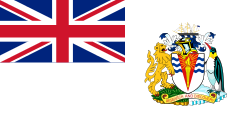 British Antarctic Territory British Antarctic Territory
The British Antarctic Territory (BAT) is a sector of Antarctica claimed by the United Kingdom was formed on 3 March 1962, although the UK's claim dates back to 1908 and 1917. The area now covered by the Territory includes three regions which, before 1962, were administered as separate dependencies of the Falkland Islands: Graham Land, the South Orkney Islands, and the South Shetland Islands. The Territory overlaps the Antarctic claims of Argentina and Chile.
It is inhabited by the staff of research and support stations operated and maintained by the British Antarctic Survey and other organisations, and stations of Argentina, Chile and other countries. There are no native inhabitants.
Most countries do not recognise territorial claims in Antarctica.
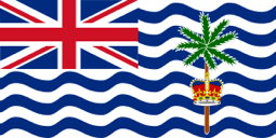 British Indian Ocean Territory British Indian Ocean Territory
The British Indian Ocean Territory (or Chagos Islands is situated in the Indian Ocean, mid-way between Africa and Indonesia. The territory comprises the six atolls of the Chagos Archipelago with over 1000 individual islands. The largest island is Diego Garcia the site of a joint military facility of the United Kingdom and the United States. Following the eviction of the native population in the 1960s, the only inhabitants are US and British military personnel and associated contractors.
Sovereign Base Areas of Akrotiri and Dhekelia
The Sovereign Base Areas of Akrotiri and Dhekelia are two British-administered areas on the island of Cyprus administered as Sovereign Base Areas of the United Kingdom created in 1960. The bases were retained by the British following the granting of independence and the eventual transition of Cyprus from a crown colony to an independent sovereign state. The United Kingdom demanded and succeeded in continuing to occupy a portion of Cyprus in the form of military bases because of the strategic location of Cyprus.
Under the terms of the 1960 agreement with Cyprus establishing the Sovereign Base Areas, the United Kingdom is committed not to use the Areas for civilian purposes.
British Empire

The very first Crown colony was the English Colony of Virginia in the present-day United States, after the Crown took control from the Virginia Company in 1624. Most former colonies are now independent nations.
The former British Empire comprised the self-governing dominions as well as colonies, protectorates and mandates administered by the United Kingdom.
Dominions have included (at varying times) Canada (1867–1982), Australia (1901–1942), New Zealand (1907–1986), Newfoundland (1907–1949), the Union of South Africa (1910–1961), India (1909–1950) and the Irish Free State then Ireland (1922–1949). Since 1948, the term has been used to denote those independent nations of the British Commonwealth that shared the same person as their monarch. These have included (at varying times) Pakistan (1947–1956) and Ceylon now Sri Lanka (1948–1972) in addition to the earlier dominions. Many of the former British colonies that were granted independence in the decades following World War II were called Dominions in their constitutions of independence. In many cases, these countries became republics ending their status as Dominions. The United Kingdom and the other remaining monarchies are today referred to as Commonwealth realms rather than Dominions. Note: Southern Rhodesia was never a dominion, although it was treated as a dominion in many respects.
Commonwealth Realms
Commonwealth Realms (not to be confused with the Commonwealth of Nations) currently include:
- Antigua and Barbuda
- Australia
- The Bahamas
- Barbados
- Belize
- Canada
- Grenada
- Jamaica
- New Zealand
- Papua New Guinea
- Saint Kitts and Nevis
- Saint Lucia
- Saint Vincent and the Grenadines
- Solomon Islands
- Tuvalu
- United Kingdom
British Protectorates
A protectorate is a territory which is not formally annexed but in which, by treaty, grant or other lawful means, the Crown has power and jurisdiction.
Former protectorates included:
- Aden Protectorate
- Federation of Arab Emirates of the South
- Ashanti Protectorate
- Bechuanaland Protectorate
- British Cameroons
- British Central Africa Protectorate
- British Somaliland
- British Togoland
- Anglo-Corsican Kingdom
- East Africa Protectorate
- Sultanate of Egypt
- Federated Malay States
- United States of the Ionian Islands
- Federation of Malaya
- Mosquito Coast
- Niger Coast Protectorate
- Northern Nigeria
- Southern Nigeria Protectorate
- North Borneo
- Northern Nigeria Protectorate
- Northern Rhodesia
- British Mandate for Palestine
- Mandate Palestine
- Kingdom of Sarawak
- Sikkim
- Protectorate of South Arabia
- Federation of South Arabia
- Southern Cameroons
- Tonga
- Trucial States
- Uganda Protectorate
- Zanzibar
British Mandates
A mandate was a legal status for certain territories transferred from the control of one country to another following World War I.
Class A mandates, were territories formerly controlled by the Ottoman Empire:
- Mesopotamia 1920–1932. The mandate subsequently became the independent Kingdom of Iraq.
- Palestine 1920(1923)–1948 including the Transjordan from 1921 that became the independent Hashemite Kingdom of Transjordan (now Jordan) in 1946. Most of the remaining territory became part of the State of Israel. Other parts, until 1967, formed the West Bank of the Hashemite Kingdom of Jordan, the Egyptian-occupied Gaza Strip, and small slivers of territory east and south of the Sea of Galilee held by Syria.
Class B mandates, were former German territories in West and Central Africa:
- Tanganyika 1922–1946. On 9 December 1961, it became an independent Commonwealth realm, transforming into a republic on the same day the next year. On 26 April 1964, Tanganyika merged with the neighbouring island of Zanzibar to become the modern nation of Tanzania.
- Kamerun was split in 1922 into British Cameroons and French Cameroun.
- Togoland was split into British Togoland under the British Gold Coast (present Ghana) and French Togoland.
Class C mandates, including South-West Africa and certain of the South Pacific Islands were former German possessions:
- German New Guinea became the Territory of New Guinea (Australia/United Kingdom) 1920–1946.
- German Samoa renamed Western Samoa (New Zealand/United Kingdom) 1920–1947.
Crown Colonies
Former British colonies and their various names include:
- Colony of Aden
- Alabama
- Antigua and Barbuda
- Australia
- Bangladesh
- Barbados
- Basutoland
- Belize
- Bengkulu
- Black River (settlement)
- Colony of British Columbia
- British West Africa
- British Western Pacific Territories
- Burma
- Canada
- The Canadas
- Cape Breton Island
- Cape Colony
- Carriacou and Petite Martinique
- British Ceylon
- Chesapeake Colonies
- Chopawamsic
- Colony of Natal
- Colony of Tasmania
- Colony of the Queen Charlotte Islands
- Colony of Vancouver Island
- Colony of Virginia
- Connecticut
- Connecticut Colony
- Cook Islands
- Cook Islands Federation
- Cyprus
- Con Dao
- Delaware
- Delaware Colony
- Demerara
- Dog Island, Gambia
- East Jersey
- Equivalent lands
- Essequibo (colony)
- Falkland Islands Dependencies
- Florida
- Georgia (now a US state)
- Gilbert and Ellice Islands
- Gold Coast (British colony)
- Grenada
- Guadeloupe
- British Guiana
- Heligoland
- British Honduras
- Hong Kong
- British Hong Kong
- India
- Jamaica
- Jordan
- Jubaland
- Kenya Colony
- Kunta Kinteh Island
- British Leeward Islands
- Lower Canada
- Maine
- Straits Settlement of Malacca
- Malayan Union
- Malaysia
- Malta
- Province of Maryland
- Massachusetts
- Mauritius
- Middle Colonies
- Minorca
- Mississippi
- Mombasa
- New Brunswick
- New England Colonies
- New Hampshire
- New Haven Colony
- New Hebrides
- New Jersey
- New Somersetshire
- New South Wales
- New York
- Province of New York
- Pulicat
- New Zealand
- Newfoundland and Labrador
- Newfoundland Colony
- Nicobar Islands
- Nigeria
- Colony and Protectorate of Nigeria
- Nikumaroro
- North Carolina
- Nova Scotia
- Orange River Colony
- Orange River Sovereignty
- Pakistan
- Territory of Papua
- Pennsylvania
- Plymouth Company
- Plymouth Colony
- Prince Edward Island
- Province of Canada
- Province of Carolina
- Province of Georgia
- Province of Massachusetts Bay
- Province of New Hampshire
- Province of New Jersey
- Province of Pennsylvania
- Province of South Carolina
- Province of Quebec (1763–1791)
- Queensland
- Restoration (Colonies)
- Rhode Island
- Colony of Rhode Island and Providence Plantations
- Northern Rhodesia
- Nyasaland
- Southern Rhodesia
- Roanoke Colony
- Royal Colony of North Carolina
- Rupert's Land
- Saint Christopher-Nevis-Anguilla
- Saint Kitts and Nevis
- Saybrook Colony
- Singapore
- Singapore in the Straits Settlements
- South Africa
- South Australia
- South Carolina
- South Sudan
- Southern Colonies
- Stoddart Island
- Straits Settlements
- Sudan
- Tasmania
- Tobago
- Tokelau
- Transvaal Colony
- Trinidad
- Trinidad and Tobago
- United Colonies of Vancouver Island and British Columbia
- United States
- Upper Canada
- Van Diemen's Land
- Victoria (Australia)
- Virginia
- Weihai
- Wessagusset Colony
- West Indies Federation
- West Jersey
- Western Australia
- British Windward Islands
- Wituland
- Zulu Kingdom
|